

START: Stonehaven, Aberdeenshire
FINISH: Portlethen, Aberdeenshire
DISTANCE: 10 miles (Total – 501.6 miles)
APPROXIMATE TIME: 4 hours
OS MAPS: Explorer 396 & Explorer 406
ACCOMMODATION: Allan Guest House, Aberdeen
After my last trip to Aberdeenshire had turned into a bit of a damp squib thanks to the constantly changing weather I was eager to return to finish off what I hadn’t got round to doing last time. This involved starting in the town of Stonehaven where I had finished off Coastwalk #40 and then head northwards along the coast to the city of Aberdeen. After Aberdeen I would keep heading along the coast as far as I could hopefully getting as far as the town of Peterhead.
I booked myself back into Allan Guest House in Aberdeen for a week where I had stayed last time. I couldn’t fault this fantastic B&B run by Stuart and Brenda, and was looking forward to staying with them again. However, other events nearly conspired to make this week’s walking in Aberdeen almost as disastrous as my last stay.
In the run up to my week off I had developed a bad viral infection in my throat and nose which absolutely floored me, draining me of all energy and leaving me lethargic for two weeks. Three days before I was due to head up to Scotland I was still quite weak and also coughing to the point I was being sick. I was starting to get worried that I would have to call off or delay the trip which I didn’t want to do. Fortunately, over the next couple of days my health improved, the viral infection started to clear up and I was a bit more energetic, although still not 100%. In the end I decided to head up to Scotland and see how I got on.
STONEHAVEN
It was a Sunday morning and I was a bit tired after my epic seven hour journey the previous day. I was still coughing like there was no tomorrow, but I was determined to head out for a walk. Fortified by a lovely breakfast courtesy of the B&B I was soon on the bus to Stonehaven. Even better it was also a nice sunny day.

I got off the bus in Stonehaven’s Market Square. There was actually a market going on at the time with plenty of people milling about having a look what was on offer. I didn’t though, instead heading down towards the harbour, passing by The Carron fish shop where in 1992 the world’s first deep-fried Mars bar was sold which has since gone on to be a bit of a Scottish ‘delicacy’ in subsequent years.
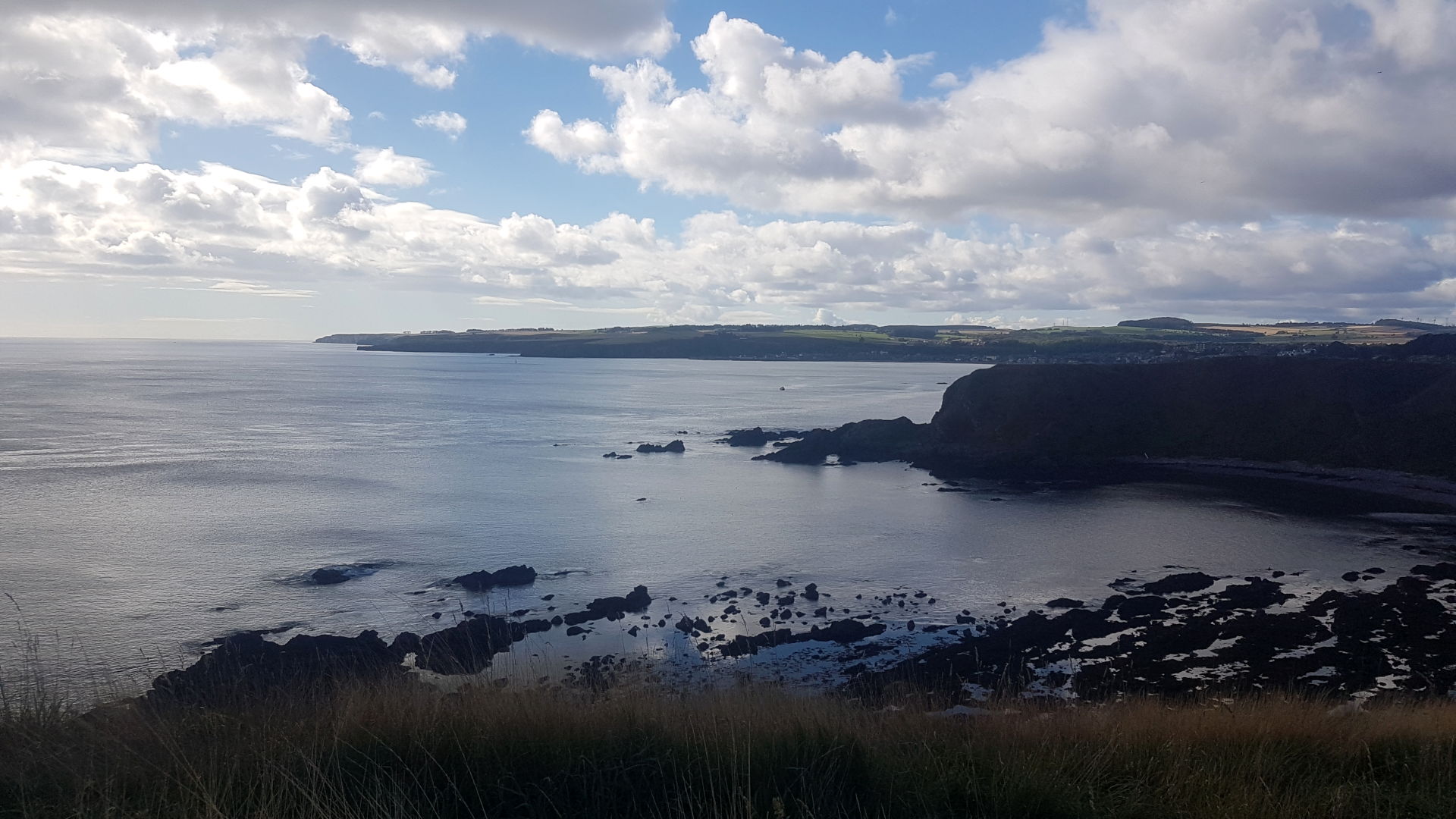
Further on was the spiky-towered Town House (right) which was built in 1790. Just past the old Town House I came to Stonehaven’s magnificent harbour (below) which was an absolute delight in the Sunday sunshine. Stonehaven has been an important port for centuries, mainly thanks to it being the only safe haven along this entire stretch of coast when a dangerous north-easterly gale is blowing.
Unsurprisingly, fishing has been Stonehaven’s main industry for several hundred years with herring being the main catch. The fishing industry peaked in the late 19th century with 15 million tonnes being caught in 1894. However, since then thanks to overfishing, the industry has declined with marine services and tourism now being the town’s main activities.

There were plenty of pleasure boats in the harbour listing in the low tide when I was there. I took one last look at the harbour before setting off on the walk proper. I headed in between the 17th century Tolbooth House and the more modern Harbour Office, coming into a small car park which was filling up with cars. From here I followed a lovely footpath along the shoreline which was very popular and with good reason. The view across Stonehaven’s beach was stunning (below) complimented by a number of maritime sculptures which were installed next to the path.

I was still coughing a fair bit but the fresh sea air was starting to do me a bit of good, as was the exercise. I hadn’t done much in the way of physical activity over the past couple of weeks so I was having to start almost from scratch.

I crossed a bridge over Cowie Water and a short while later I came to the small village of Cowie itself. Cowie was once an important fishing village in its own right, even more so then Stonehaven, however over the centuries the balance of power shifted a little southwards and Stonehaven became the major fishing port at the expense of Cowie. Nowadays, Cowie’s harbour is crumbling under the waves, the fishing boats have long gone and the village itself is just a quiet dormitory place at the edge of Stonehaven.
Cowie may be a quiet place but to geologists and paleontologists it is a paradise. In 2003 local amateur paleontologist, Mike Newman, had been chiseling away at rocks in the Cowie area (something he had been doing for the past 12 years) when he came across something that wowed the scientific community. He discovered a tiny less-than-a-centimetre long fossil of a millipede. What made this tiny fossil so special was that it was 420 million years old and was 20 million years older than any other air breathing creature discovered so far. Scientists now had to rethink the timescale of the great migration of life from the seas on to land which had started much earlier than they had previously thought. The new millipede was named Pneumodesmus (‘air breathing’) Newmani, after its discoverer although I think calling the fossil ‘Mike’ would have been less of a mouthful.

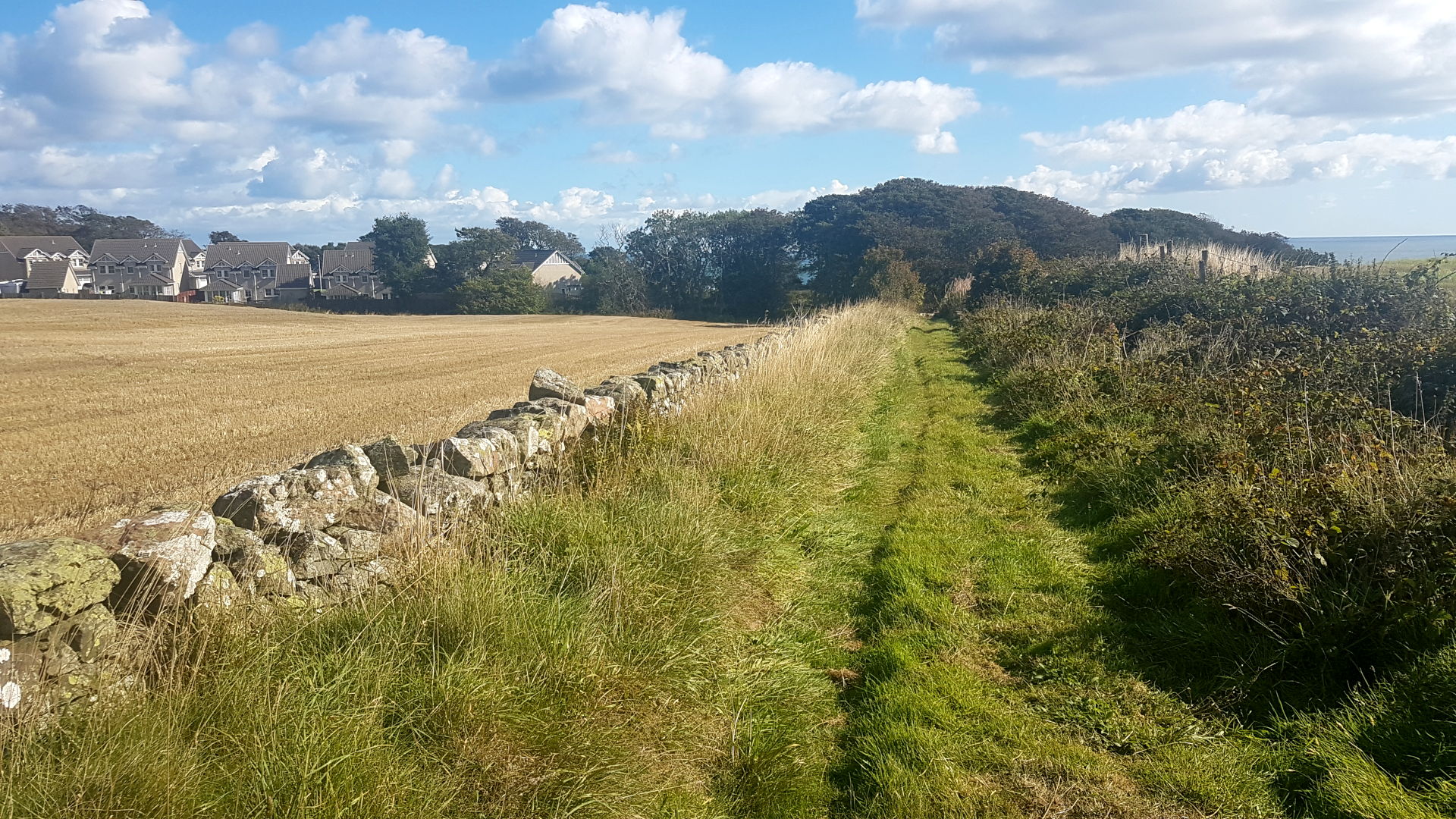
I didn’t go all the way into Cowie itself, instead just after passing a line of old fishermen’s cottages I took a left into a narrow lane, at the end of which was a path up into the main road that went into Stonehaven. I didn’t go back into Stonehaven, instead I followed the footpath to the right until I came to a gap in a fence where a grassy track led along the clifftops. There were great views from here (above) and at some point along this stage I crossed, geologically speaking, into the Highlands of Scotland. The Highland Fault Line, which marks the geological boundary between the older Dalridian metamorphic rocks of the Highlands and the younger Devonian sedimentary rocks passes just to the north of Cowie. So now I was in the Highlands. Hooray!

Ahead I came across a ruined church complete with graveyard which was really well looked after. This church is dedicated to St Mary and St Nathalan, a local priest who built a small chapel on the site of the church in the 7th century. St Nathalan died in 678AD and there is a tradition that he owned great treasure which is buried somewhere in the kirkyard.

The present kirk dates from the 13th century and was built on the site of St Nathalan’s earlier chapel. Several Scottish monarchs including King James IV frequently worshipped here. The kirk fell into disuse following the Reformation and the local people began to remove the stones for building other habitats despite a legend stating that the stones would rain drops of blood on any house that was built with them. Gruesome stuff!
Leaving the kirk behind I edged around the outside of the stone-walled kirkyard, almost tripping over a man who had decided to have a nap in the long grass next to the path. Adjacent to the old kirkyard is a golf course which I had to spend the next mile or so edging around. The views were magnificent though and this golf course must be one of the most scenic in Scotland.
A little later at the edge of the golf course I came to a deep wooded gully. I followed a track down into the gully which headed underneath a bridge carrying the railway line to Aberdeen, before doubling back on the other side into the northernmost tip of the golf course. I didn’t go back into the golf course though, instead I walked through a narrow tunnel built into the trackbed of the railway and then along an overgrown path which brought me out on to a road.
From here I headed along a narrow gravel path which brought me alongside the very busy A92 road. For the next couple of miles I had to put up with the constant roar of traffic. The fumes from the many vehicles probably weren’t doing my cough much good either. I could only get the occasional glimpse of the sea as it was hidden behind a railway embankment. Eventually, about forty-five minutes later, I headed down a grassy track which took me into the small village of Muchalls.
MUCHALLS & NEWTONHILL
For centuries Muchalls was a traditional fishing village, which lay originally over a kilometre south of its present location at Muchalls Shore. The original village was abandoned following two fishing disasters in a short period of time which led to the remaining fishermen moving south to the safer waters of Stonehaven and everybody else to move north and found the new settlement.
Muchalls had a reputation for being a centre of smuggling and there is said to be a tunnel which was used to move contraband goods from the shore to Muchalls Castle which lies about a mile inland. A ghostly story is attached to this tunnel . According to the story the daughter of one of the castle’s tenants was a lover of one of the smugglers who used the tunnel on a regular basis. On one fateful day she saw her lover’s boat approaching and ran to the tunnel to meet him. Unfortunately she slipped and fell into the water and was later found drowned by her now ex-lover. Her ghost is still said to haunt Muchalls Castle, even though the smugglers tunnel was sealed upin the 19th century.
In the 19th century Muchalls became a bit of a resort and Charles Dickens visited here describing the village as a ‘remarkably beautiful place’. He certainly is right as Muchalls is a nice quiet village set back from the hustle and bustle of the A92.
From Muchalls it is a short hop to the town of Newtonhill. To get there I headed north out of Muchalls along a farmers track, passing over Phebbie Burn before coming to a large farmhouse on the right. Here the farm track joined a much wider road which swung towards Newtonhall. About a quarter of a mile down the road I took a right along a track which went through a wood before bringing me out into a residential street. I followed the street – called Park Place – until it ended at Newtonhill Road. Here I took the road to my right, crossing a bridge over the railway line to Aberdeen before swinging left down Old Mill Road. A short while later I headed downhill along Skateraw Road, at the bottom of which was a couple of benches overlooking the beautiful Newtonhill Bay. It was here that I decided to take my lunch break.

Newtonhill is technically split in two by the railway, with the eastern half being the oldest part of the village, the original fishing settlement of ‘Skateraw’. Many of the older locals say that the much larger and newer western half of the town is actually Newtonhill.
Sitting on the bench overlooking Newtonhill Bay I could see what little was left of the old harbour, just a couple of old stone cottages and some tumbledown sheds. Newtonhill was a busy fishing port in the 1800’s, with great quantities of haddock and cod being landed here. Whilst the men were out fishing at sea, usually during the night, the women of the family were out collecting mussels and limpets which were then baited to the fishing hooks.

This backbreaking job was not the only task that the women of the family had to do. When the catch was brought in they also had to climb from the harbour up to the fish houses located along the top of the cliffs, whilst carrying a heavy basket (known as a creel) which was filled to the brim with fish. Once a week they had to carry the smoked haddocks the twelve miles to Aberdeen where they were sold in the fish market.
It wasn’t an easy life for the families of Newtonhill. In the 1880s there were sixty men putting out to sea on a daily basis, with another 150 employed in activities related to the fishing trade. This wasn’t to last though as the arrival of the steam trawler in the same decade led to an exodus of people who moved to new jobs in Aberdeen and Stonehaven. Nowadays Newtonhill, like the other towns and villages along this coast, is a quiet commuter settlement, a haven of peace and quiet.

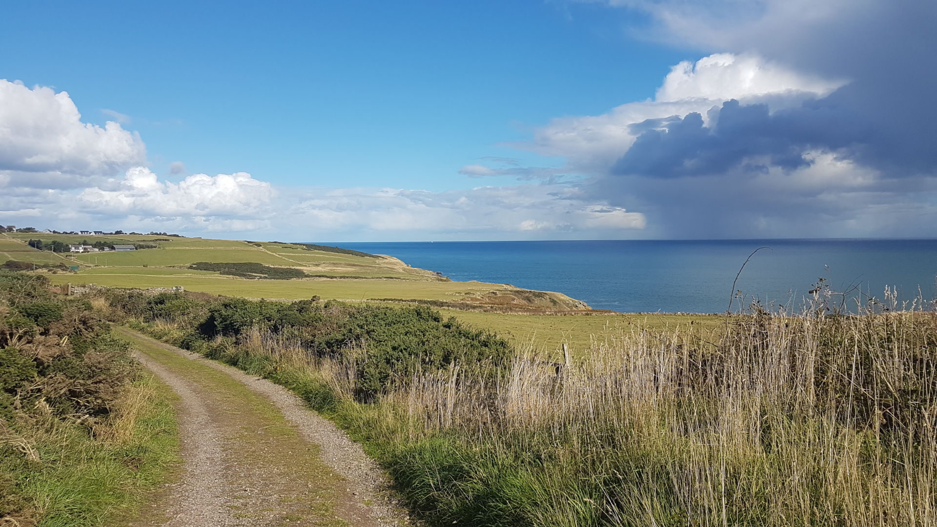
After I finished my bite to eat I set off down a set of steps which took me to the little beach in Newtonhill Bay. A dark cloud was threatening to cause a bit of wetness so I picked up my pace a little, climbing up another flight of steps at the other side of the beach which brought me out onto a narrow road next to a cottage. Ahead there was a path through a field which I followed, soon coming out onto a farmers track. I ambled along this track for a mile, rounding the hump of Cran Hill, whilst gaining some fantastic views up the coast (below). Thankfully the dark cloud had passed over and was now adding some more water to the North Sea. At some point on this stretch I also passed the 500 mile mark on my coastal walk which was a bonus. A short while later I came into the tiny village of Downies.
DOWNIES & PORTLETHEN
Downies was once a traditional fishing community until the collapse of the industry due to overfishing in the early 20th century. A century later the village is just a dormitory settlement for nearby Aberdeen.

I headed through the village, soon coming to a grassy track which led away off to my left. This was the Old Coast Road which used to be the main route between Downies and Portlethen Village (or Old Portlethen as it is now known). This was still the quickest way to get to Old Portlethen despite more modern roads linking the two settlements so I followed the Old Coast Road for a mile or so until I came into Old Portlethen where I finished off my walk. Unfortunately public transport doesn’t serve Old Portlethen so I had to walk a mile inland in to the much larger settlement of Portlethen in order to get the bus back to Aberdeen.

Whilst on the journey back to Aberdeen I reflected on the day’s walk. It had been a good start to the week’s walking and I was happy to get another coastal walk under the belt. I felt as if I had a bit more energy than I did at the start of the day when I was hacking and coughing about and generally feeling sorry for myself. I was looking forward to the next day’s walk where I would finally get to Aberdeen, a target I had been aiming for all year since starting off in North Queensferry in Fife in the spring. It had been fantastic walking all the way from there and I couldn’t wait to continue onwards. The Granite City of Aberdeen beckoned.
REFERENCES
Stonehaven
https://en.wikipedia.org/wiki/Deep-fried_Mars_bar
https://www.undiscoveredscotland.co.uk/stonehaven/stonehaven/index.html
https://en.wikipedia.org/wiki/Stonehaven
http://www.bbc.co.uk/scotland/whereilive/coast/stages.shtml?walk=northeast&stage=2
Click to access Chap1_Local_Geology-_The_Highland_Fault_2_page.pdf
https://www.stmarysstonehaven.org/the-chapel-of-st-mary-and-st-nathalan.html
Muchalls & Newtonhill
https://muchallseye.webs.com/history.htm
http://discovereastgrampiancoast.com/en/places/central/muchalls.html
https://aboutaberdeen.com/Muchalls-Castle-Stonehaven-Ghost-Story
http://www.newtonhill.biz/newton-home/newtonhill-local-history/newtonhill-skateraw/
Downies and Portlethen
http://www.newtonhill.biz/newton-home/newtonhill-local-history/downies-and-portlethen/

James, a great read and photos. Well done on passing 500 miles!
Rich
LikeLiked by 1 person
Many thanks Rich! I’ve still got plenty more mikes left to do!
LikeLike